Last Updated on January 28, 2022 by Cory Kawa
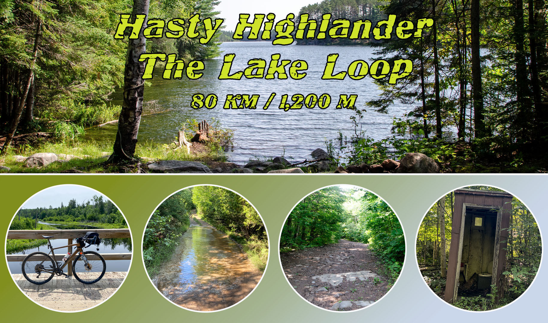
I recently had the opportunity to ride the Lake Loop, an 80km extension of the Hasty Highlander bikepacking route by Matthew Kady.
The Hasty Highlander comes in two forms, the 802km Hasty Highlander or the 587km Hasty Highlander Lite. Both routes offer two optional sub loops, including the 80km Lake Loop you’re reading about now.
From what I understand in connecting with Matthew, the Hasty Highlander Lite also serves as his recently created replacement to his version of the COLT, created by Miles Arbor and found on bikepacking.com. My understanding is that the modifications may remove some of the crazier sections of the COLT in and around Bancroft.
This is the photo essay of my day riding the Lake Loop.
Route Notes
Parking – Day parking at Dungannon Recreation Centre plus what appears to be an empty lot at Detlor and 62.
Elevation Profile – Ride with GPS shows 819m. My Garmin measured 1,201m, noting a slight routing error may have added at most 100m.
Speed Profile – Technical but not too technical, flirting on the edge of insanity and rideable. Lots of technical but rideable ATV and Snowmobile trails made for a slower than average ride.
Route Profile – Roughly 20% asphalt, 30% gravel, 40% snowmobile trail, 10% ATV trail.
Safety Profile – No issues with cars, but lots of signs of animal life throughout. I didn’t test it, but Telus appeared to have one bar of coverage throughout. Very backwoods on the eastern end. I would only recommend this to someone who likes being in the backwoods and is comfortable riding more technical terrain.
Stores – No, only what you bring on the bike.
Crown Land Camping – Egan Lake and Sparrow Lake.
Favourite Part – Quirks and Mississippi Road.
Least Favourite Part – The routing errors I talk about below.
My Stats – 80km, 1,200m climbing, 5:10 total time, 4:36 moving time, 17.2km moving speed
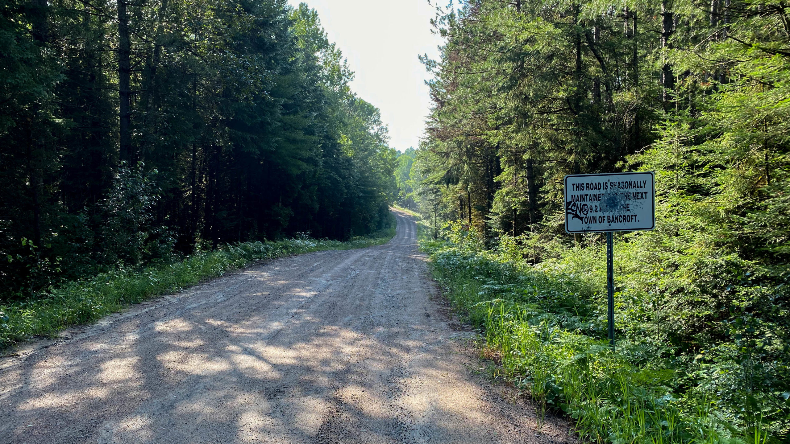
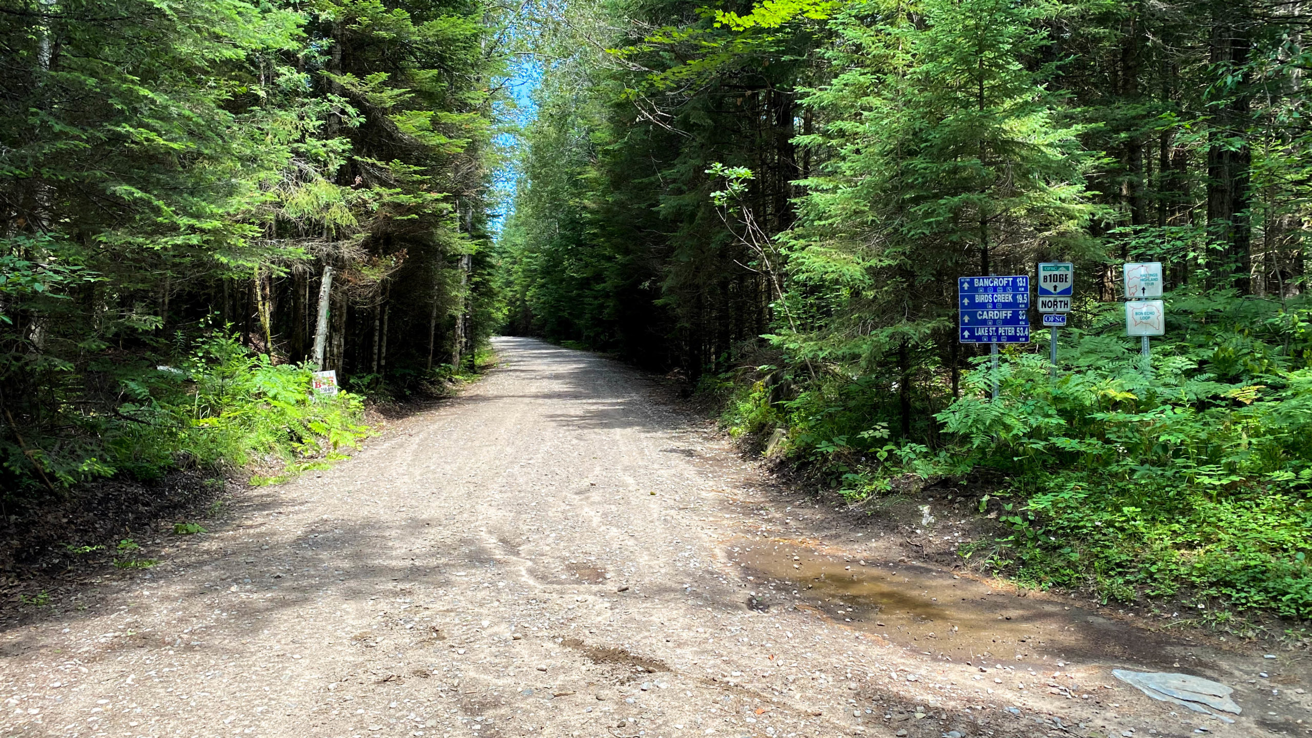
Upper Turriff Road – Kms 1.5 – 21.5
The loop starts in the L’Amable about 10 mins south of Bancroft, or 2.5 hours northeast of Toronto.
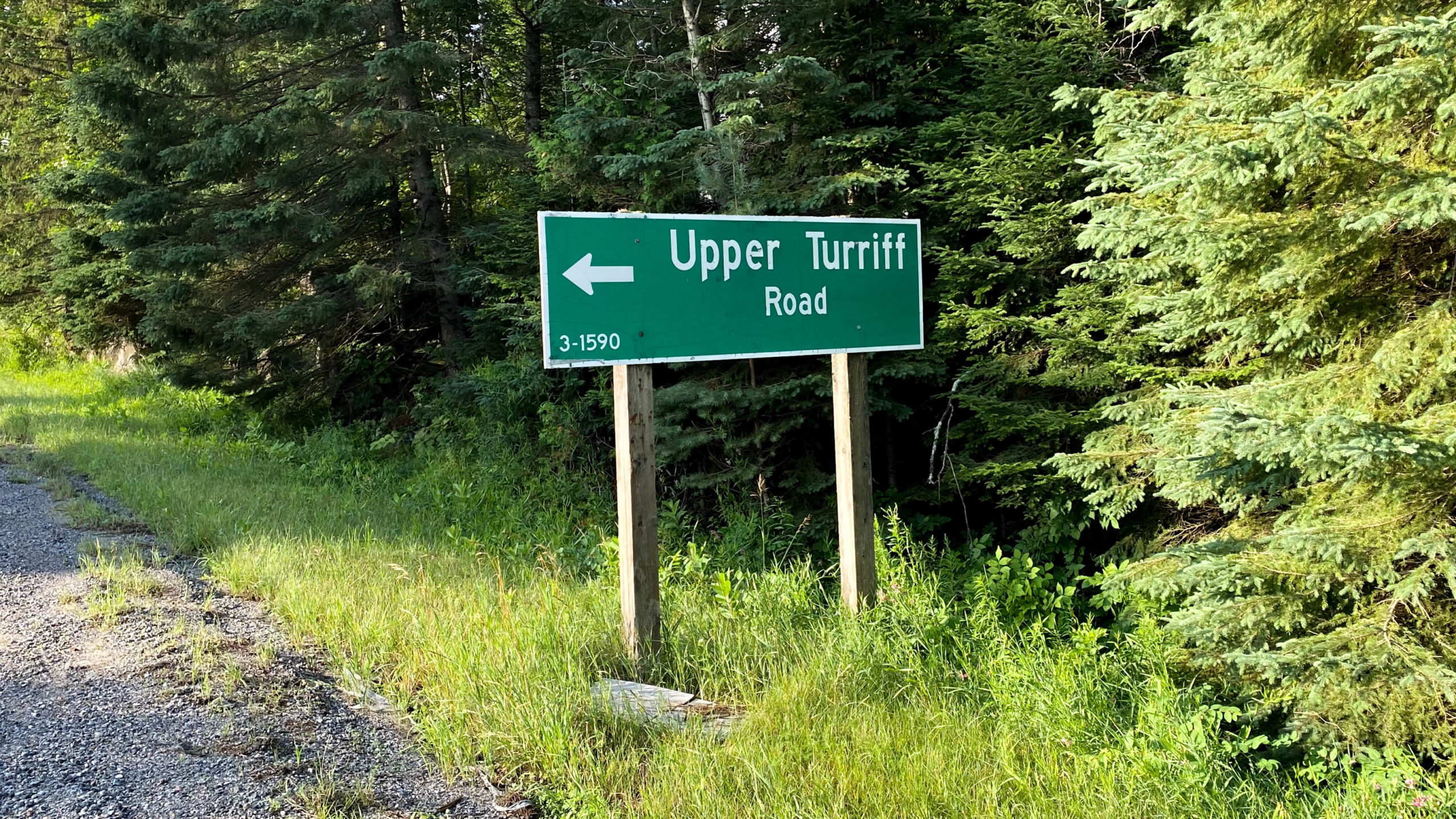
After a brief 1.5km jaunt south along Hwy 62, the route begins with the turn onto Upper Turriff Road.
If you’re arriving here as part of the Hasty Highlander, you’d be around the 260-270km mark depending upon which iteration of the route you’re doing.
Upper Turriff starts with a few km’s of decent asphalt.
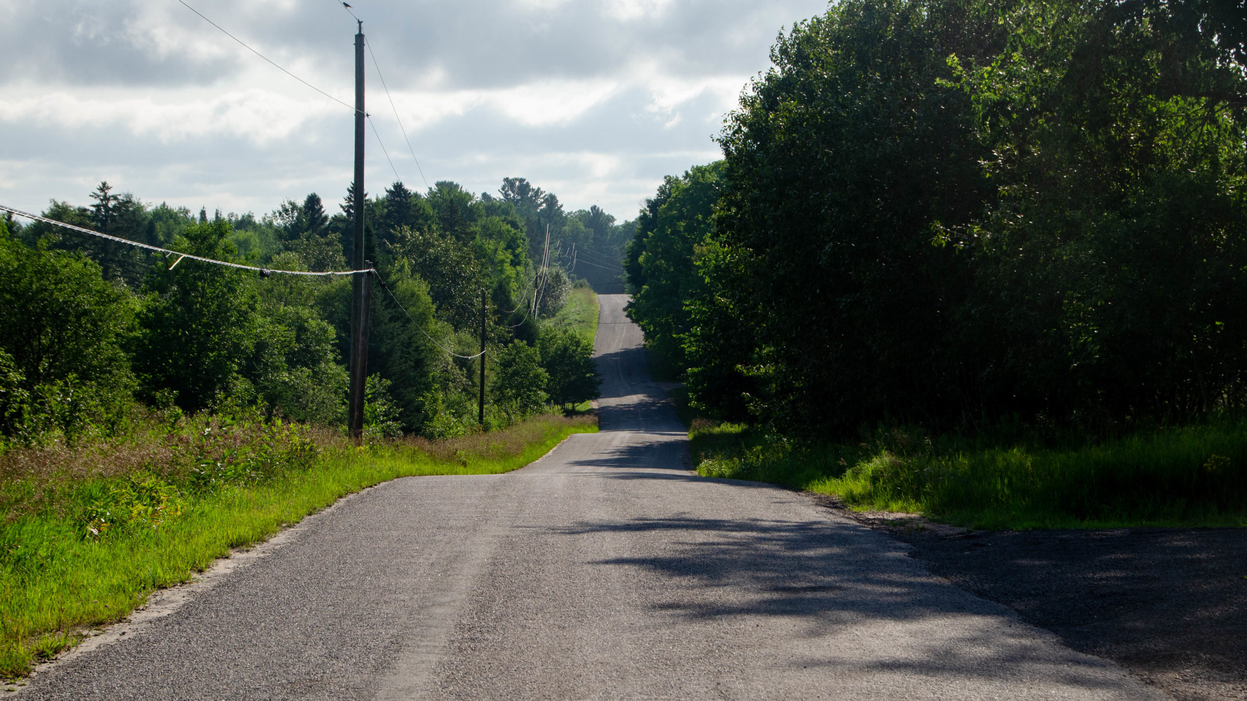
A few km later, the road slowly deteriorates, then 8km in, just east of Bradshaw Road, it transitions once more, this time to some very rideable “seasonally maintained road.”
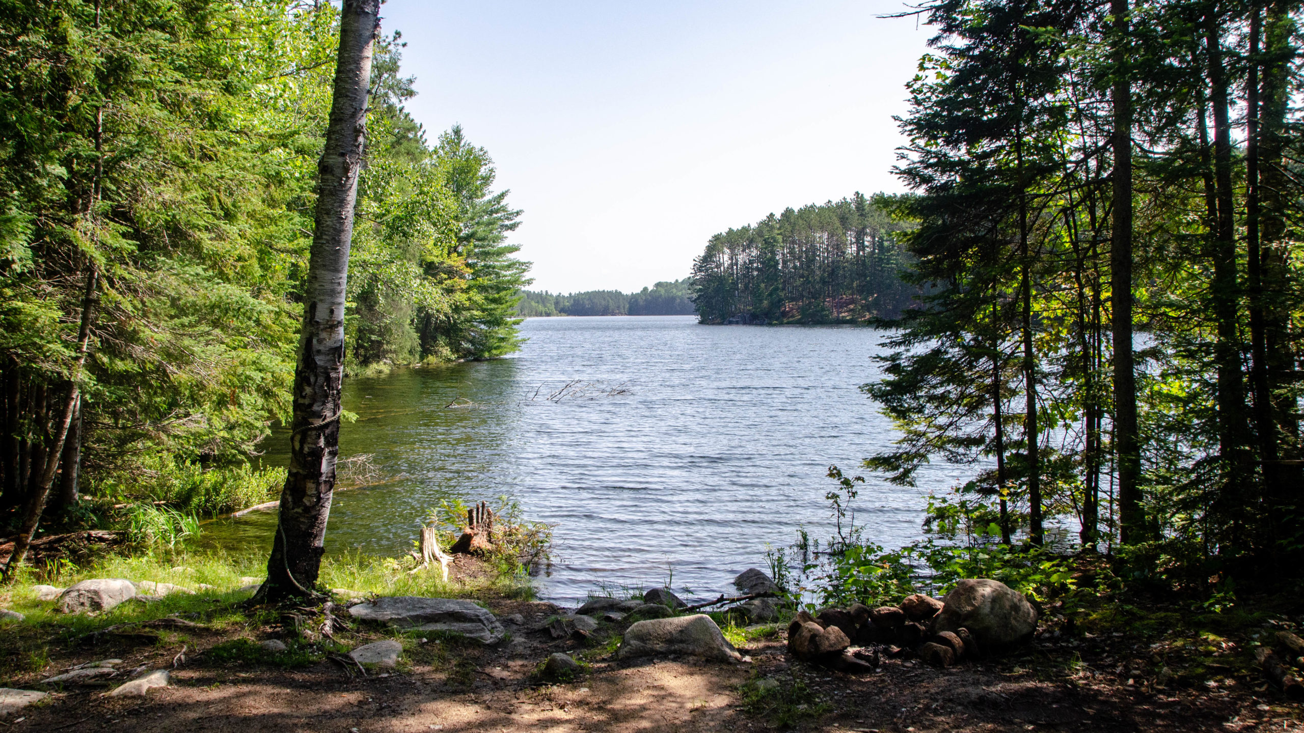
Camping Option – About 14km down Upper Turriff, you can turn onto the unmarked Egan Lake access for an early option for crown land camping. I used to camp here about 25 years ago, and from what I recall, it was pretty good, although it did get quite busy on weekends.
Quirks and Mississippi Road’s – Kms 21.5 – 44.3
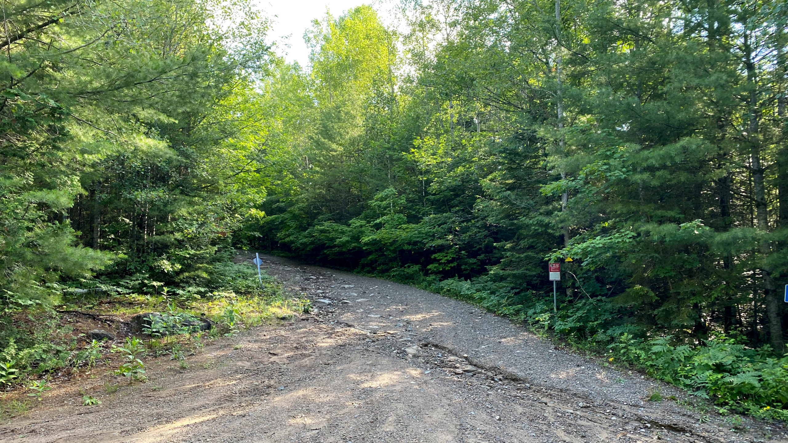
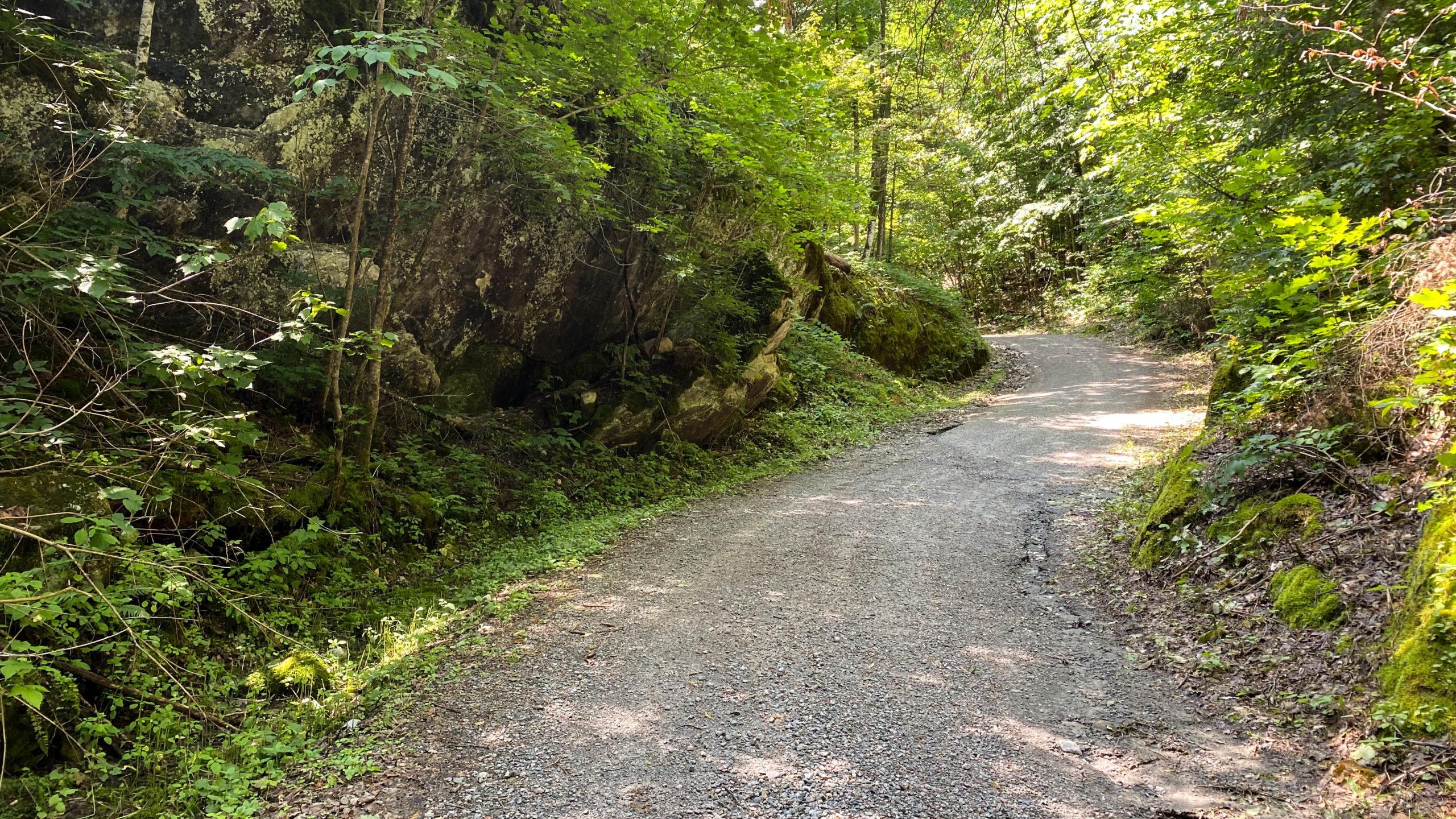
21.5 from the start, the real riding begins with the turn onto Quirks Road, followed by the aptly named Mississippi Road.
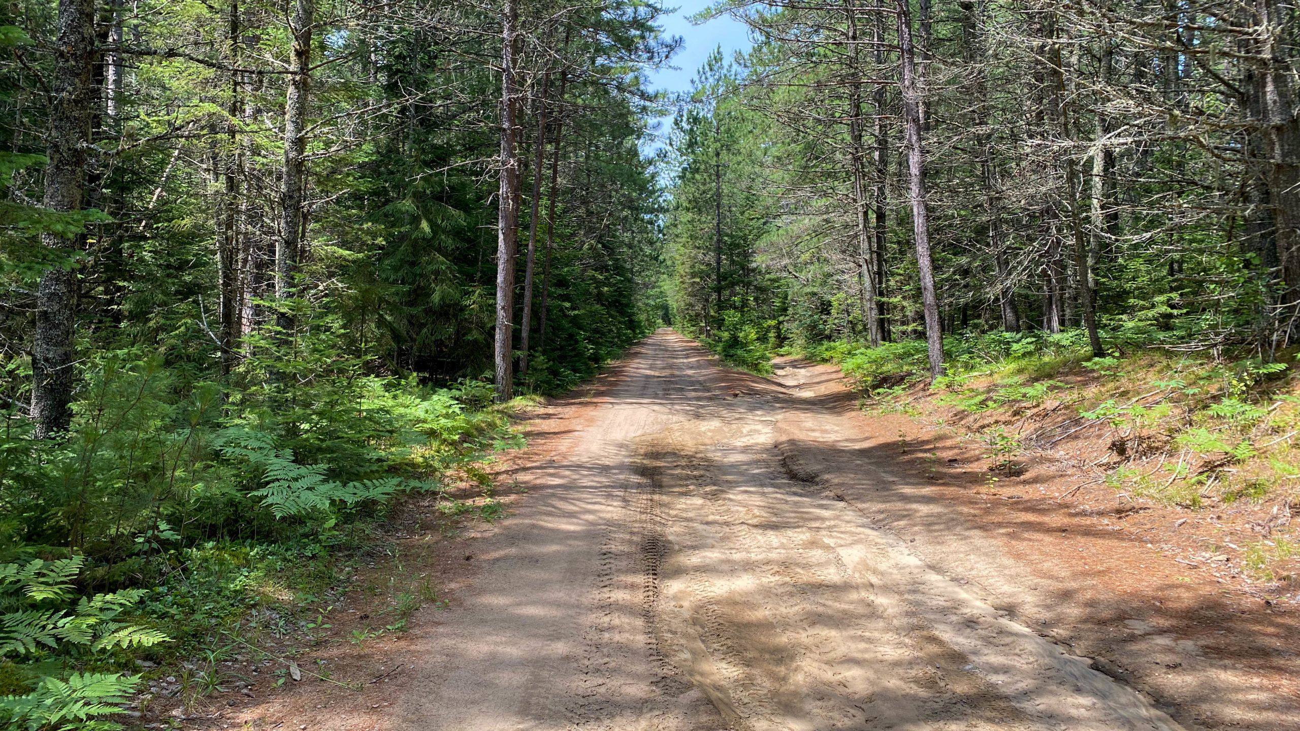
Quirks and Mississippi are amazing, simply because of how isolated they are from any and all signs of humanity. Calling these roads is more than a stretch. At best, they are unmaintained, untravelled snowmobile trail with not a sign of cars, ATVs, or people to be found for the first twelve or so kilometres.
As I pedalled, alone in the wilderness, I was happy about two things, I had bear spray, and two, my Telus seemed to hold onto one bar of basic coverage throughout.
I’m happy to report, I didn’t see a single bear. That said, I did see bear dung and plenty of deer throughout.
Although I was alone in the wilderness. I never felt truly alone.
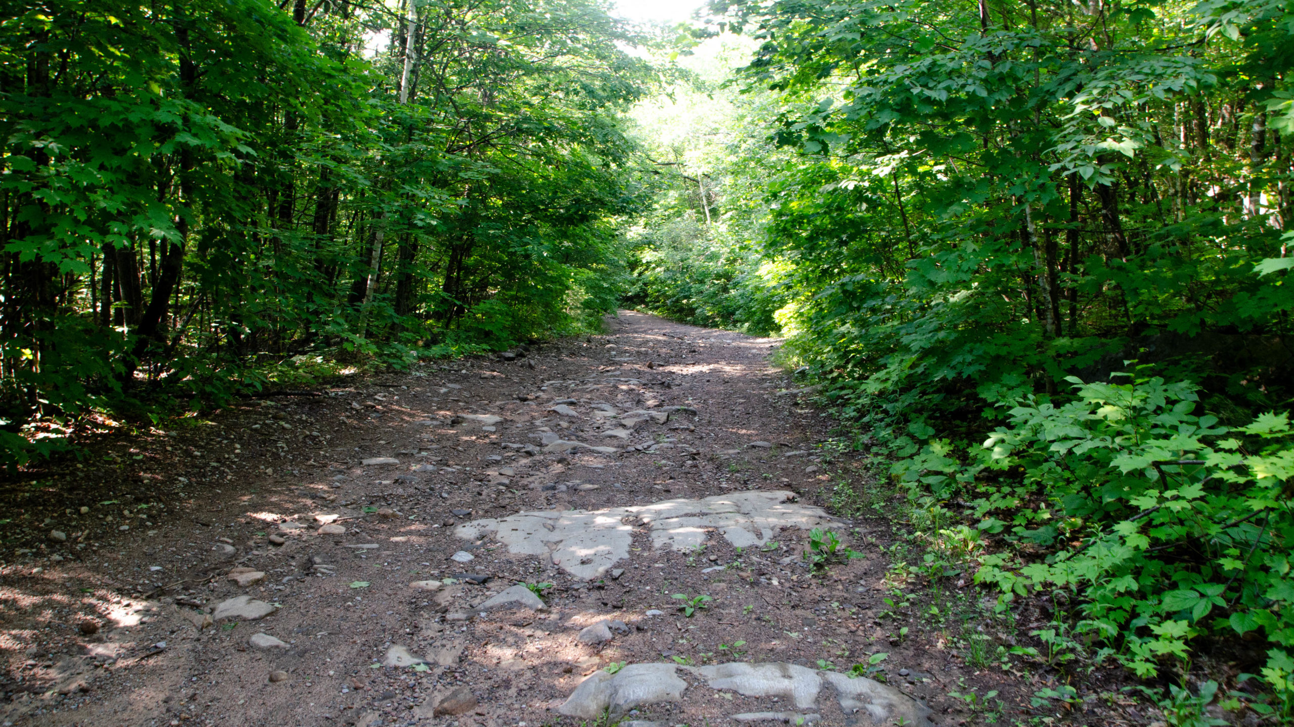
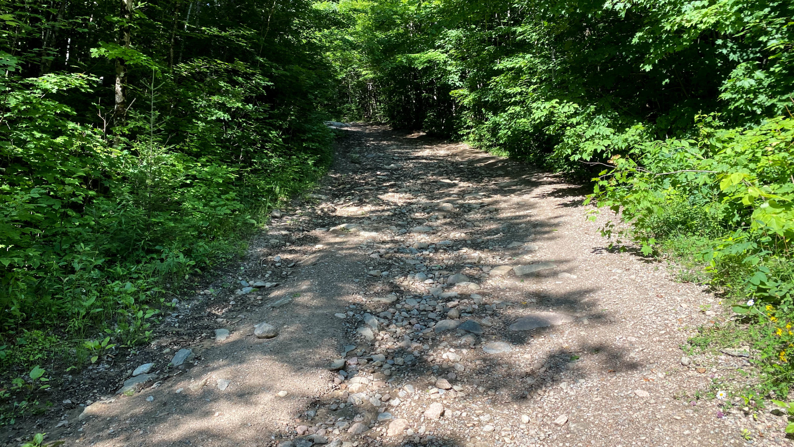
Lots of rocky climbs, sandy climbs, and tough technical descents throughout.
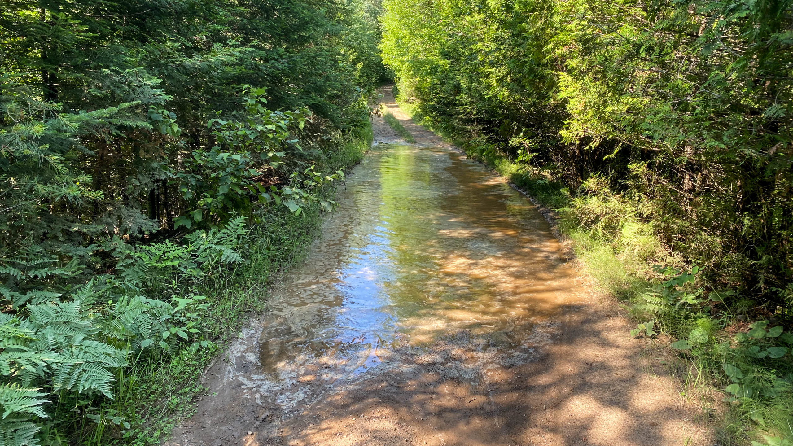
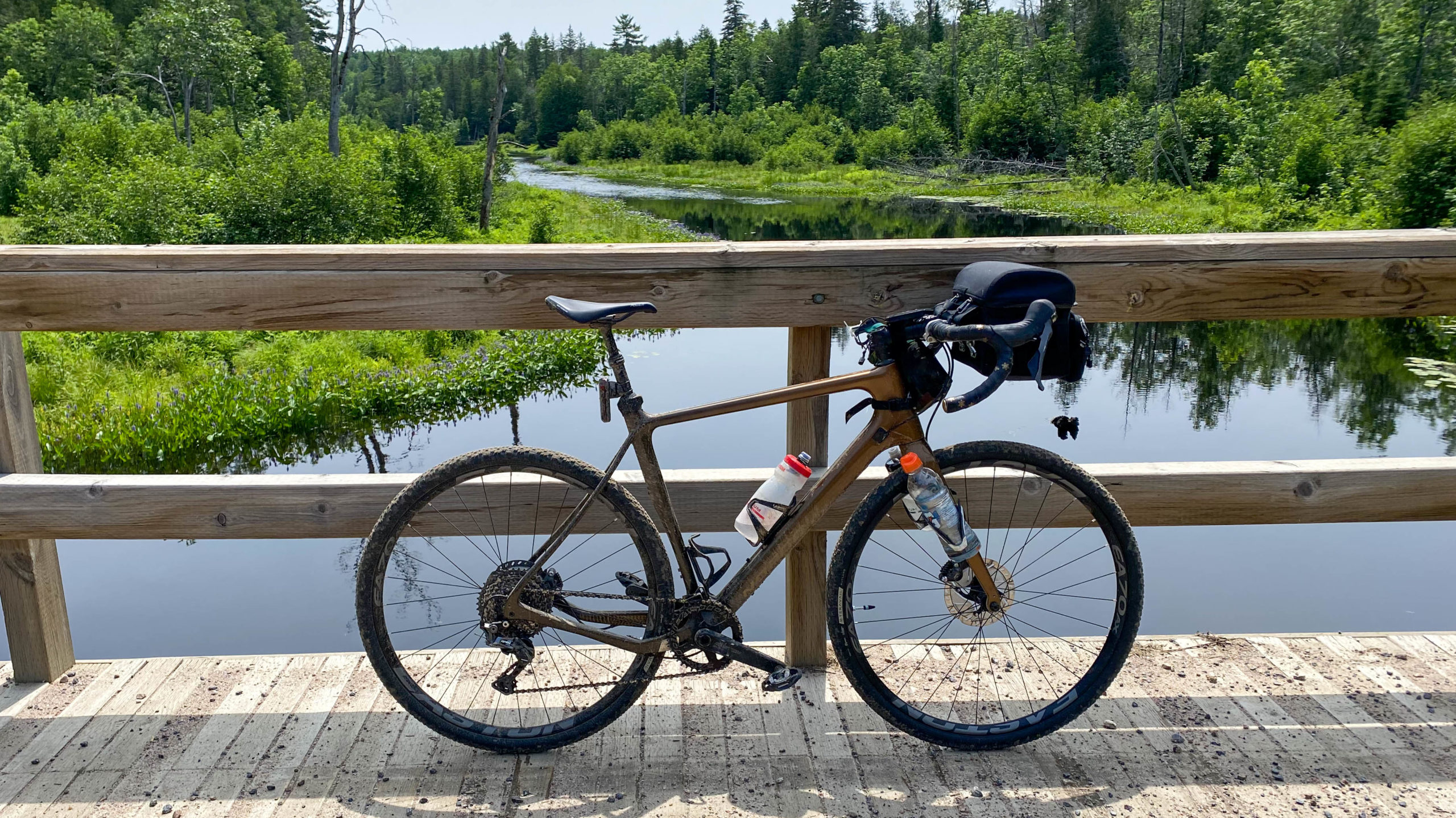
As you can see in the shot below, the ground was still damp and somewhat muddy from the previous night’s rain, making me wonder how sandy it could become.
Beautiful vistas across many marsh crossings.
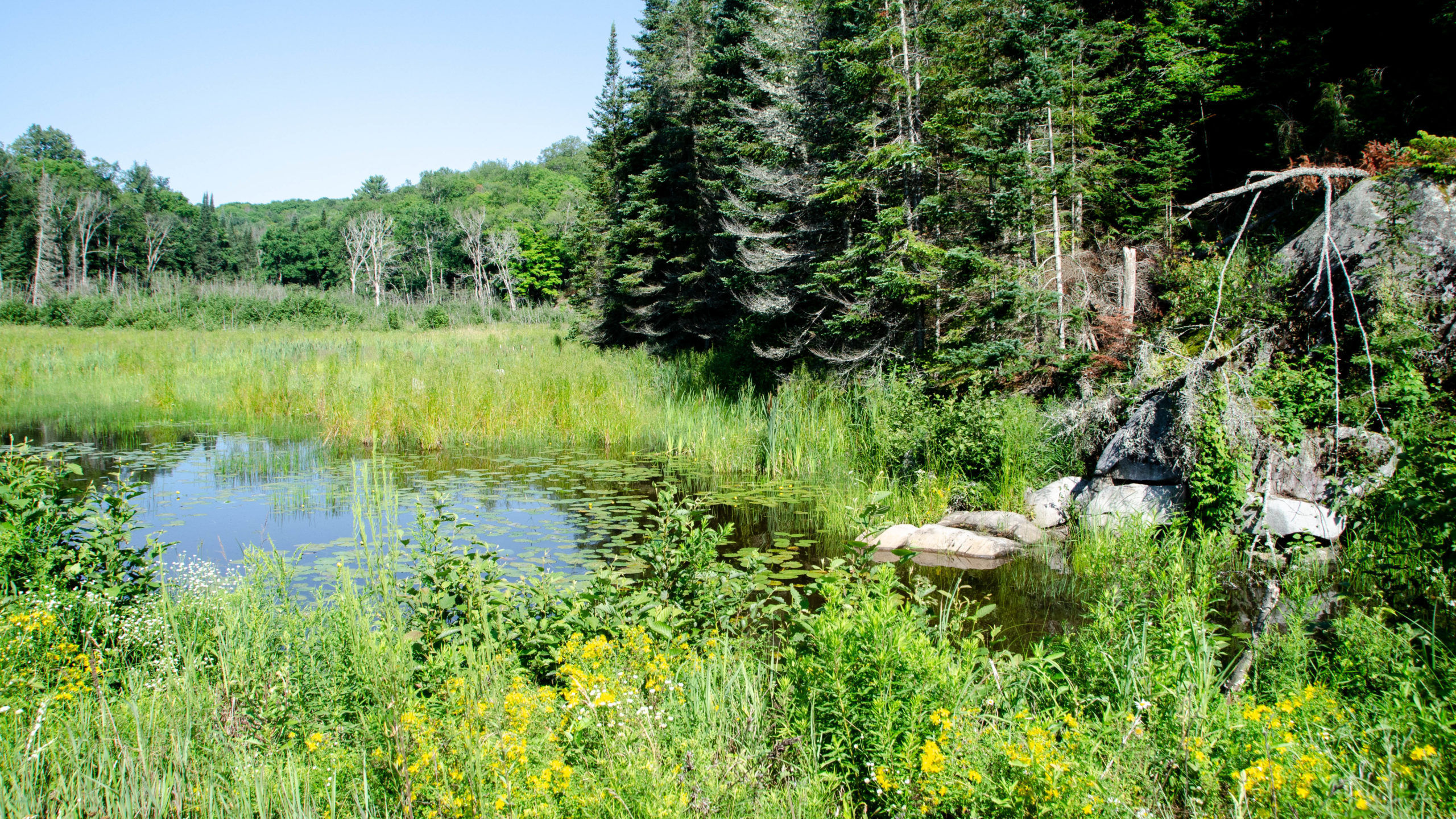
Most of which included at least one or two major puddles.
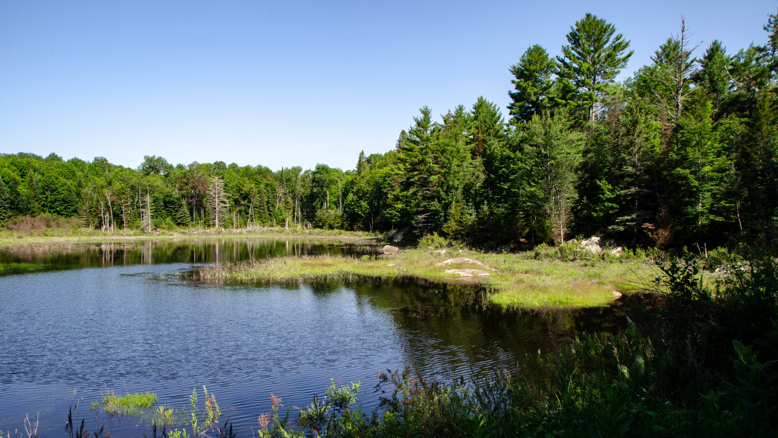
About thirty seconds before taking this picture, a solitary deer was knee-deep, enjoying a drink. Unfortunately, as I fumbled to get my camera out, it heard the noise and was gone.
As bad as the various climbs, descents, and water crossings were, they were all ridable on my 42cc tires. If this does get sandier under dries conditions, wider tires may be required.
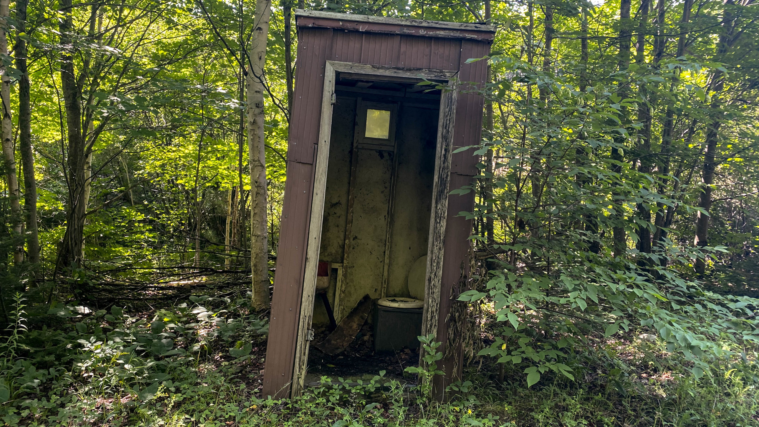
For anyone who needs it, a washroom’s stocked and available about 31km in.
An amazing, isolated camping spot exists on the southern edge of Sleeper Lake. Due to how isolated it is, I doubt this spot gets too busy.
Hartsmere Road – Kms 44.5 – 50.5
Mississippi ends at Hartsmere road.
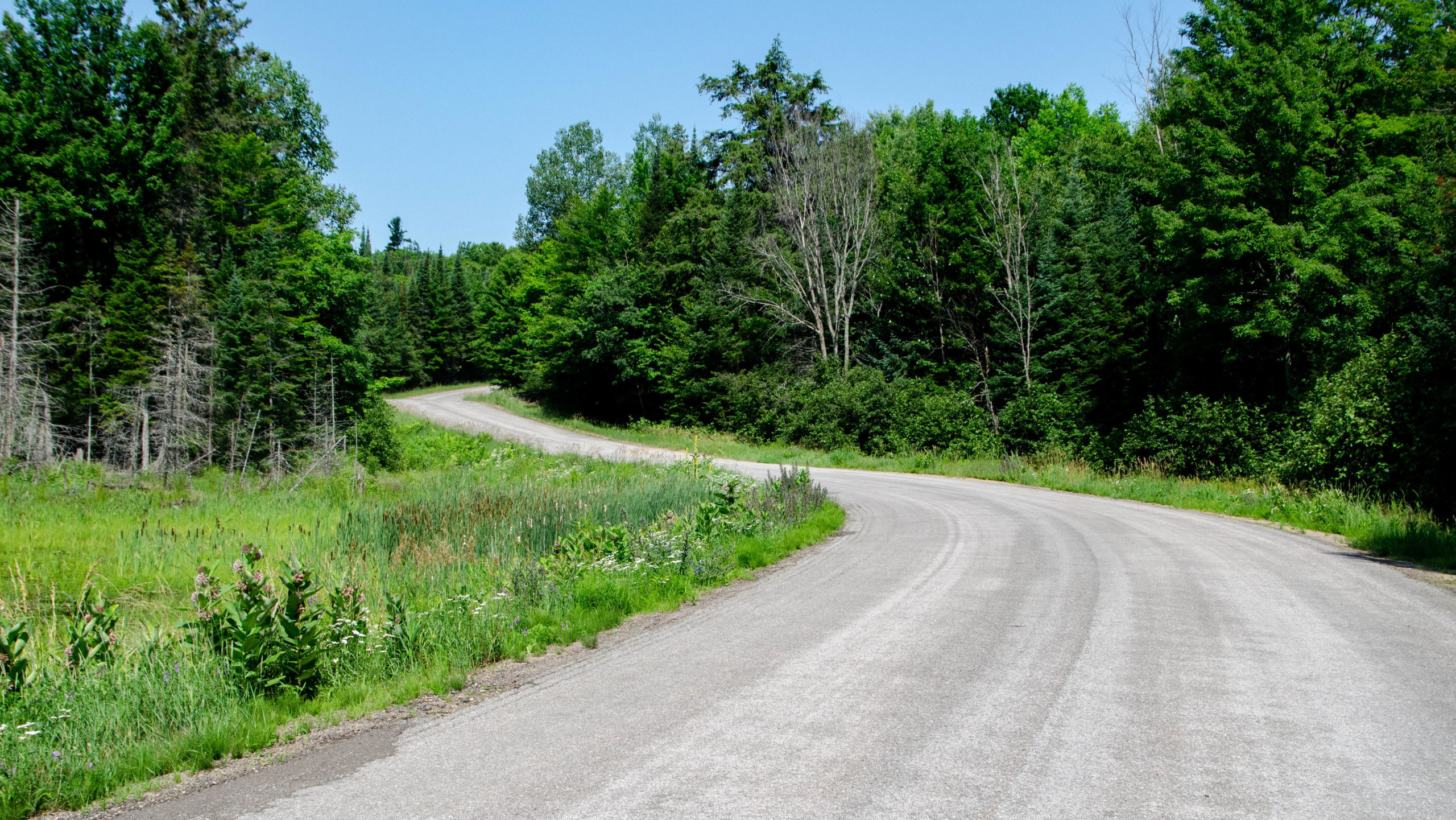
After Quirks and Mississippi, Hartsmere 6km of freshly resurfaced asphalt were a welcome relief.
Stopping for a photo that just didn’t turn out quite as well as I’d hoped.
That further down Hartsmere I went, the better the asphalt became. Gravel is great, but fresh asphalt has its benefits too.
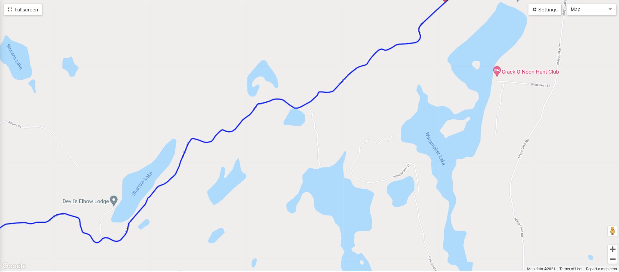
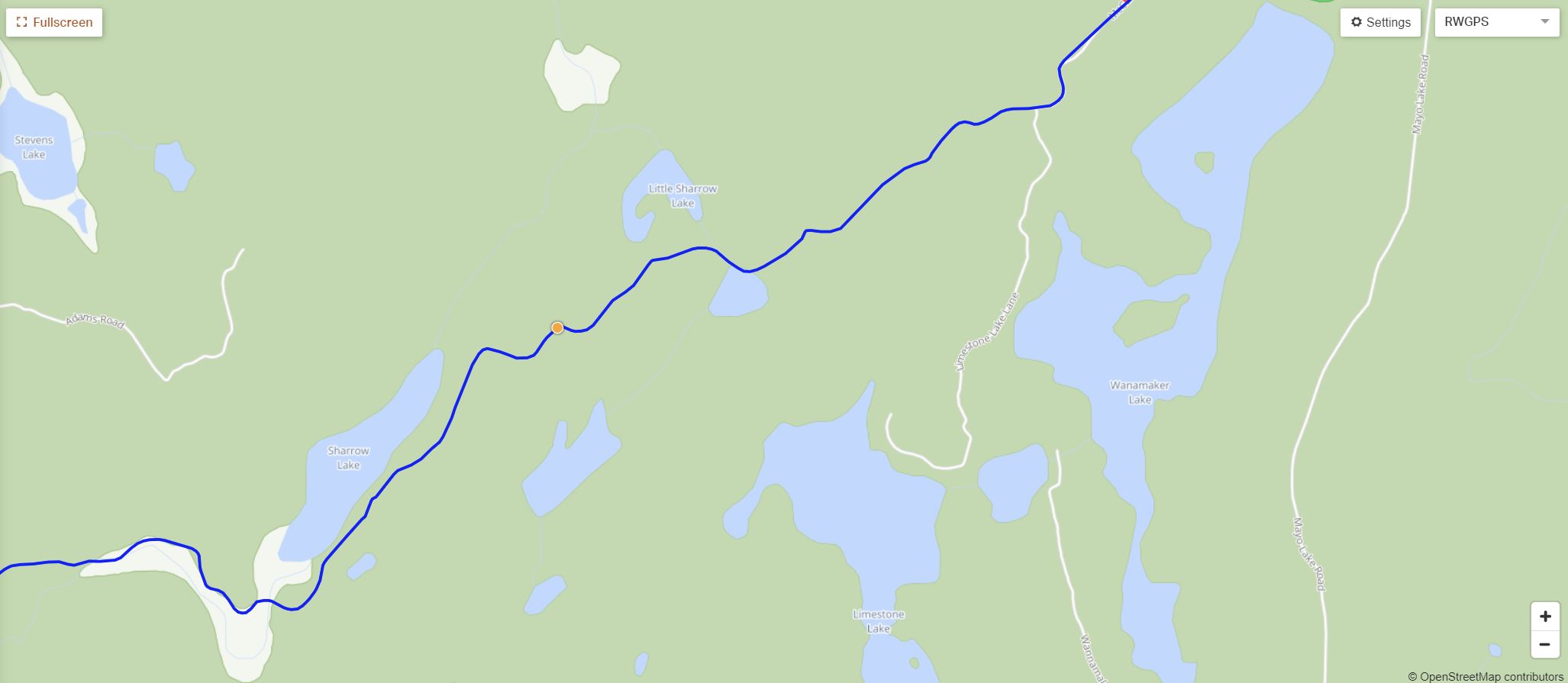
A Note on GPS Routing Errors – Km 52.8
For Clarity – Both the Hasty Highlander Route file, and the route file I posted above are correct. The issues I talk about below were created by modifying the Hasty Highlander RWGPS file and have since been updated on my modified version to remove any errors.
Just before turning onto Hartsmere, my Garmin went nuts, with constant beeps asking me to make a u-turn.
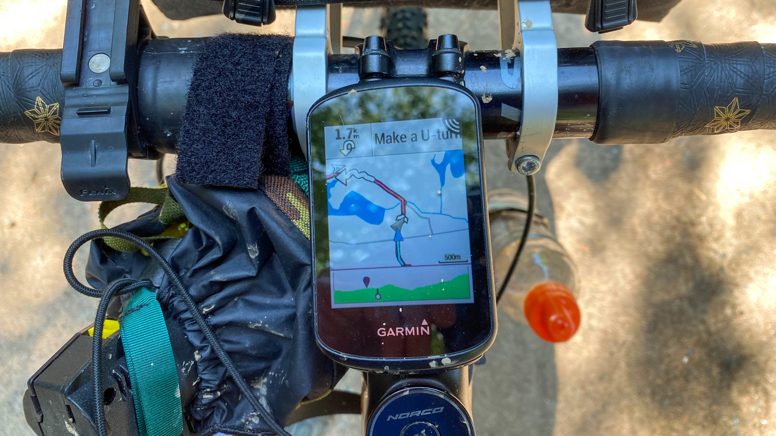
For at least thirty minutes, this beeping went on, and on, and on.
I turned my Garmin on and off multiple times, and it simply wouldn’t stop.
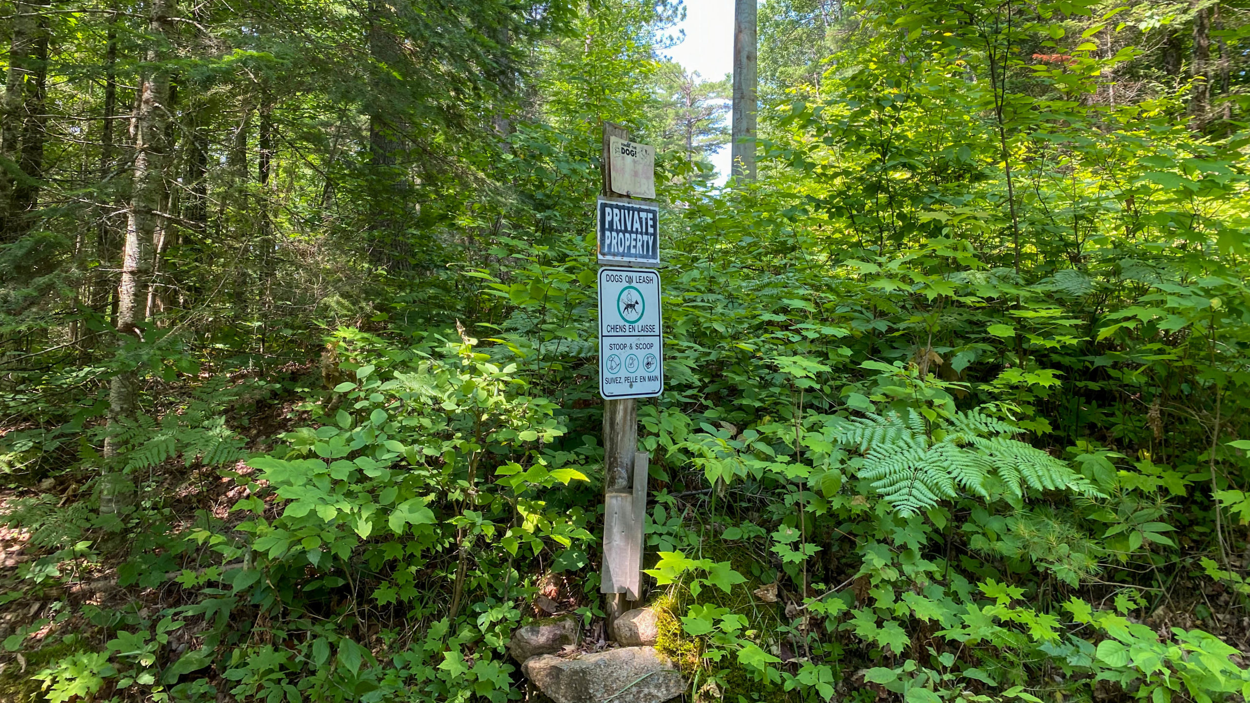
As I approached the end of Limestone Lake Lane, I looked past this sign and realized that the route was not only trying to take me across private property but directly through Limestone Lake as well.
And I think this was why.
To make a long story short, I’m not sure how this happened. I’ve even tried to replicate it at home after the fact without success, but…
When I crafted the route, I looked at the Hasty Highlander Route, cropped it, and added to it to complete the loop.
And somehow, when I did that, I ended up with this.
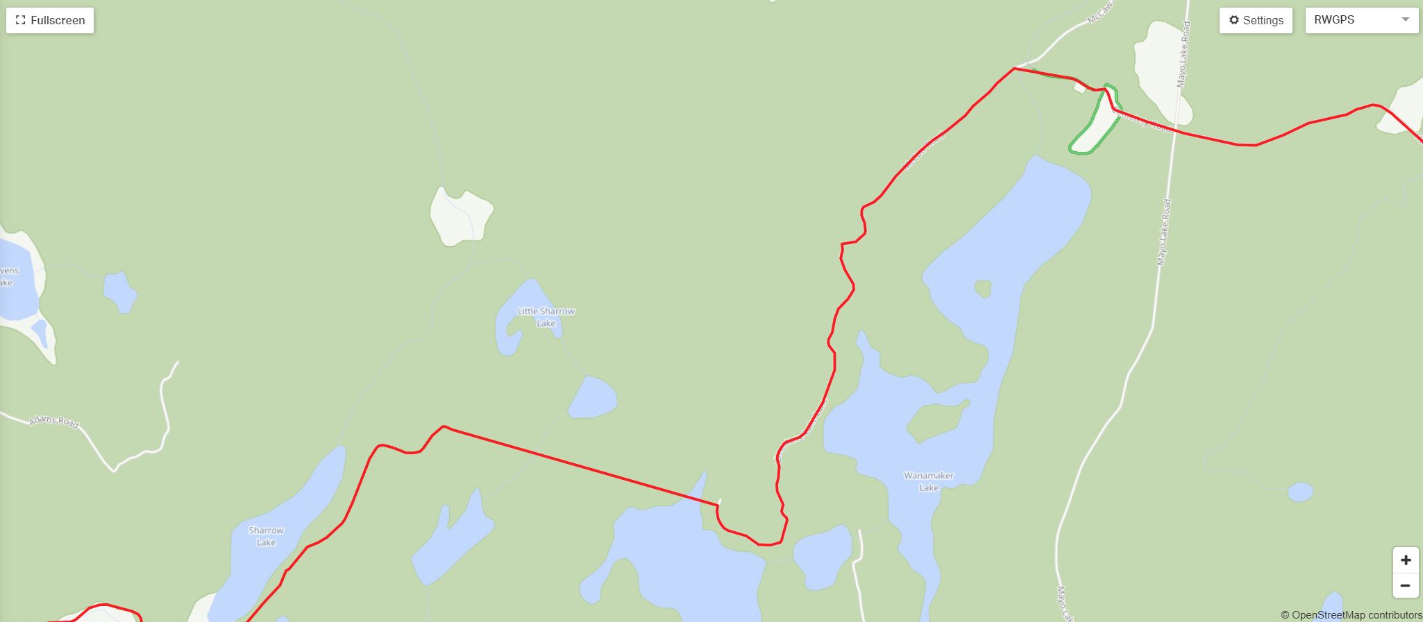
As compared to this from the Hasty Highlander route file.
The interesting quirk that I think caused this to happen is, as you may be able to see when zooming into the maps above and below.
The “RWGPS” map below shows the route but doesn’t actually see the roads that connect Limestone Lake Lane to Bessemer Road.
As compared to the “Map” above, which shows the entire stretch of McCaw Road from Limestone Lake to Bessemer Road but doesn’t show Limestone Lake Lane.
My thoughts are that the Garmin somehow picked up this error, got confused, and started constantly prompting for the u-turn.
Luckily I had my phone as a backup because I was confused and concerned as I looked at my Garmin, backtracked my route, and saw that Garmin also showed no road continuing west of Limestone Lake Trail.
Bessemer and the Hastings Heritage Trail – Kms 60.8 – 73.5
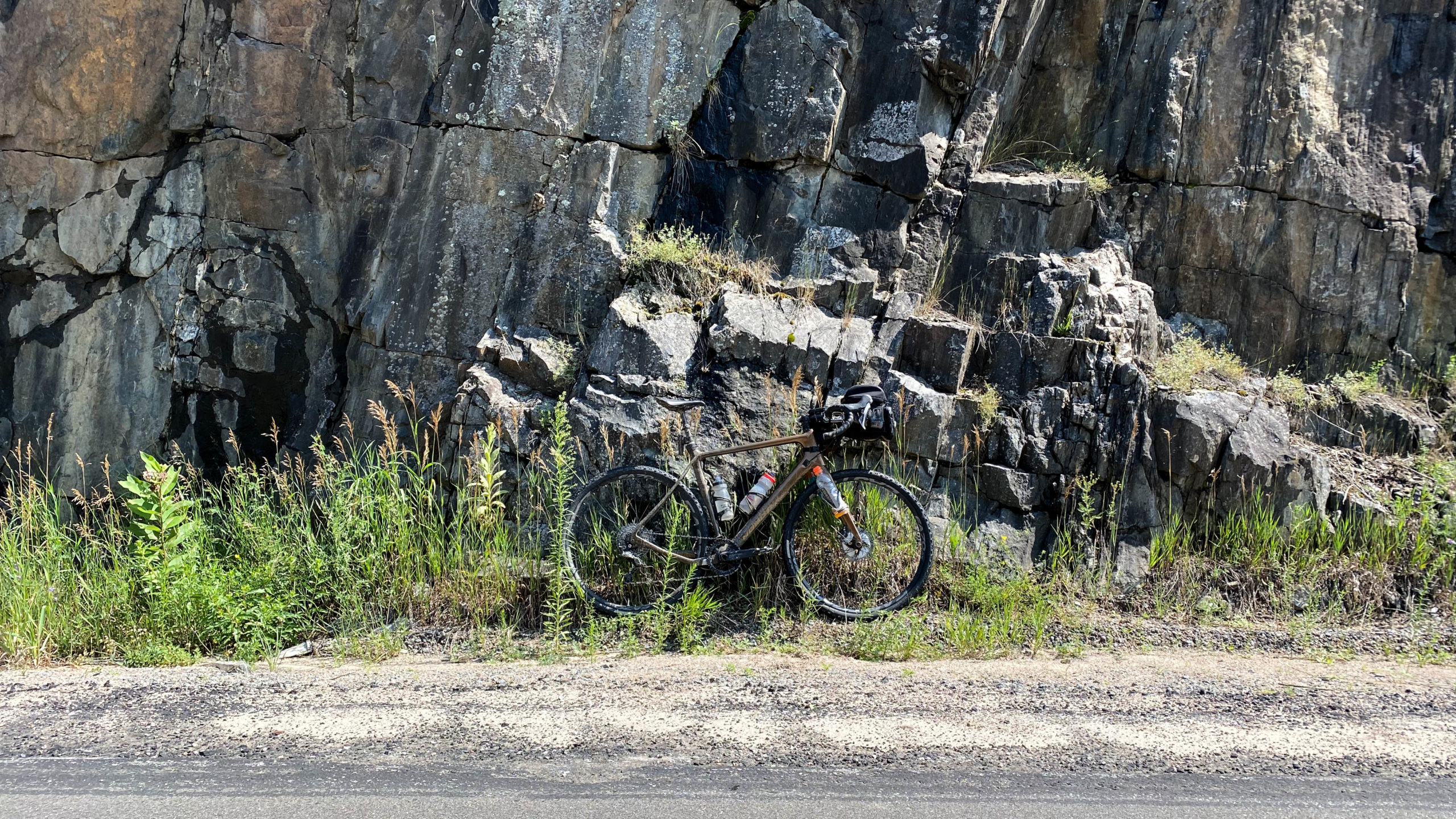
After my 5km detour of confusion was complete, I was on a mission for home, breezing through the faster but sandy at times Bessemer Road/Lane/Trail.
Only stopping for a quick drink, bite, and photo.
Today’s route ended with a brief ride along the sandy but rideable Hastings Heritage Trail. It was about 1.5km in that I turned off at Detlor Road and looped back to the start.
If you’re doing the full Hasty Highlander, you’ll continue north for 20km of mixed trail, gravel, and asphalt into Bancroft.
Thanks for reading,
Cory
Disclaimer – All opinions expressed on this blog are my own and are based on my experiences researching and riding various gravel and bikepacking routes. These routes are unsupported, unmaintained, and unsanctioned. Anyone attempting these routes should do their own due diligence to ensure the route files are current, that they’re not crossing private property and that the route and conditions are within their own abilities. Everyone’s riding abilities are different and extreme caution should be used when attempting any new routes as route conditions are constantly changing. I also do not guarantee that the information I’ve shared is up to date. You are responsible for your own safety, and I accept no responsibility for any injuries or property damage that may occur if you decide to attempt these adventures on your own.
This looks like a pretty perfect bikefishpack route….
I really liked it. The area has lots of additional trails that can be explored for a more technical bikepacking adventure. The funny thing is at one time this did show as an optional section of The Hasty Highlander, but was apparently removed due to the risk of extreme beach sand.
I have a cottage near L’Amable and love this area. Bessemer and all that have so much to love. You can go south on the sometimes-sandy rail trail and get all the way to Prince Edward County (haven’t done this yet). You can do a lot of fun things north of the 28 too. Google the HHHH 2022 gravel routes for some spectacular gravel.
It’s probably one of the best areas around if you’re into true back country gravel. I’ll have to find my way back there this summer.