Last Updated on April 6, 2024 by Cory Kawa
After a great weekend camping at Grundy Lake Provincial Park, we decided to fit in one more adventure, this time at Restoule Provincial Park on Labour Day weekend.
Restoule Provincial Park
Located about three and a half hours north of Toronto, Restoule offers a little bit of everything, including three campgrounds, two comfort stations, two beaches, a boat launch, five hiking trails, two mild mountain biking trails, scenic views, day paddling, and backcountry camping along the French River.
We’ve been here twice and stayed at Putts Point Campground both times. Putt’s has everything you need, including one of the two beaches at Restoule and a centrally located comfort station.
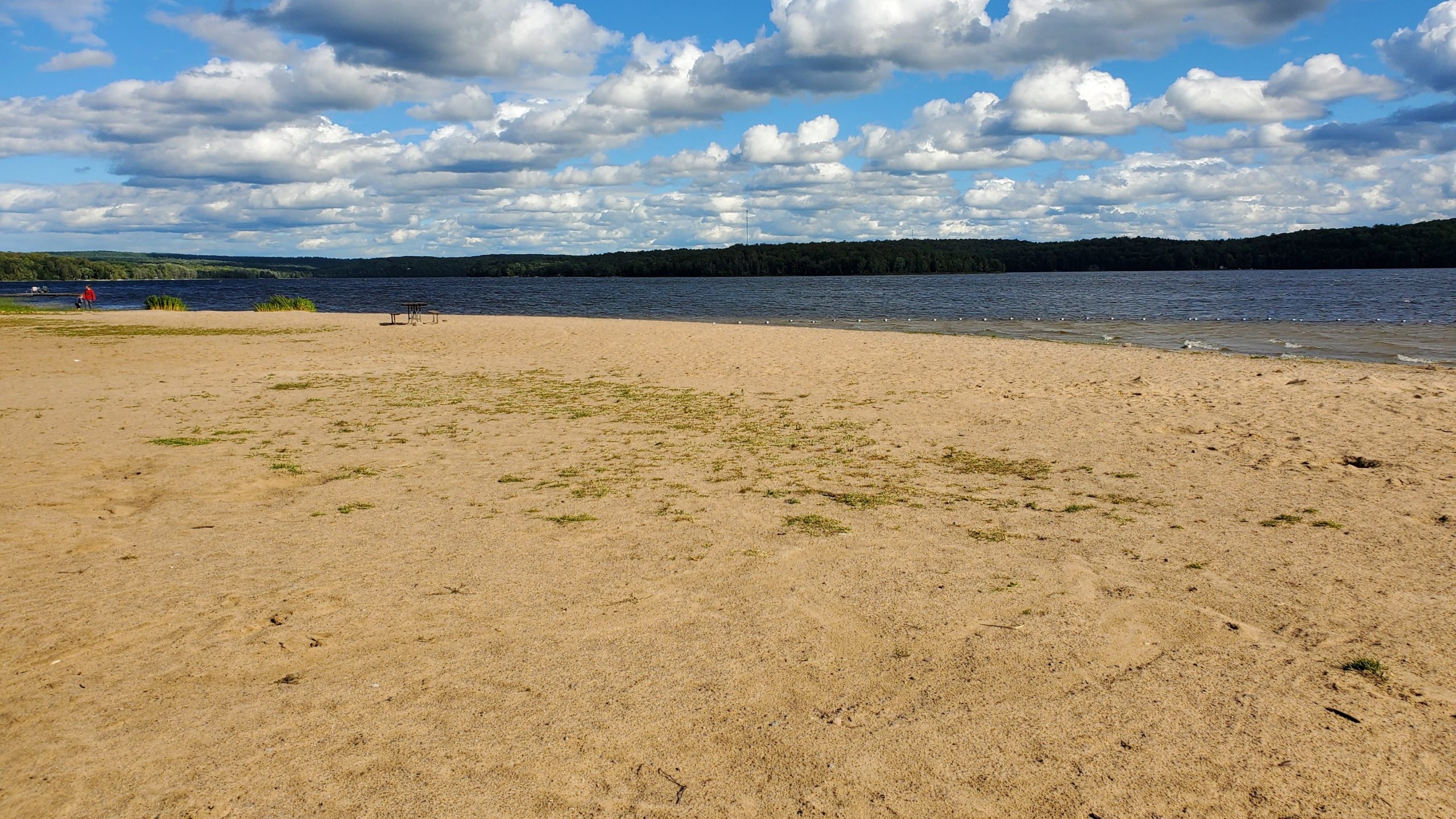
The beach at Putts Point has a long, shallow walkout and is perfect for anyone with small children.
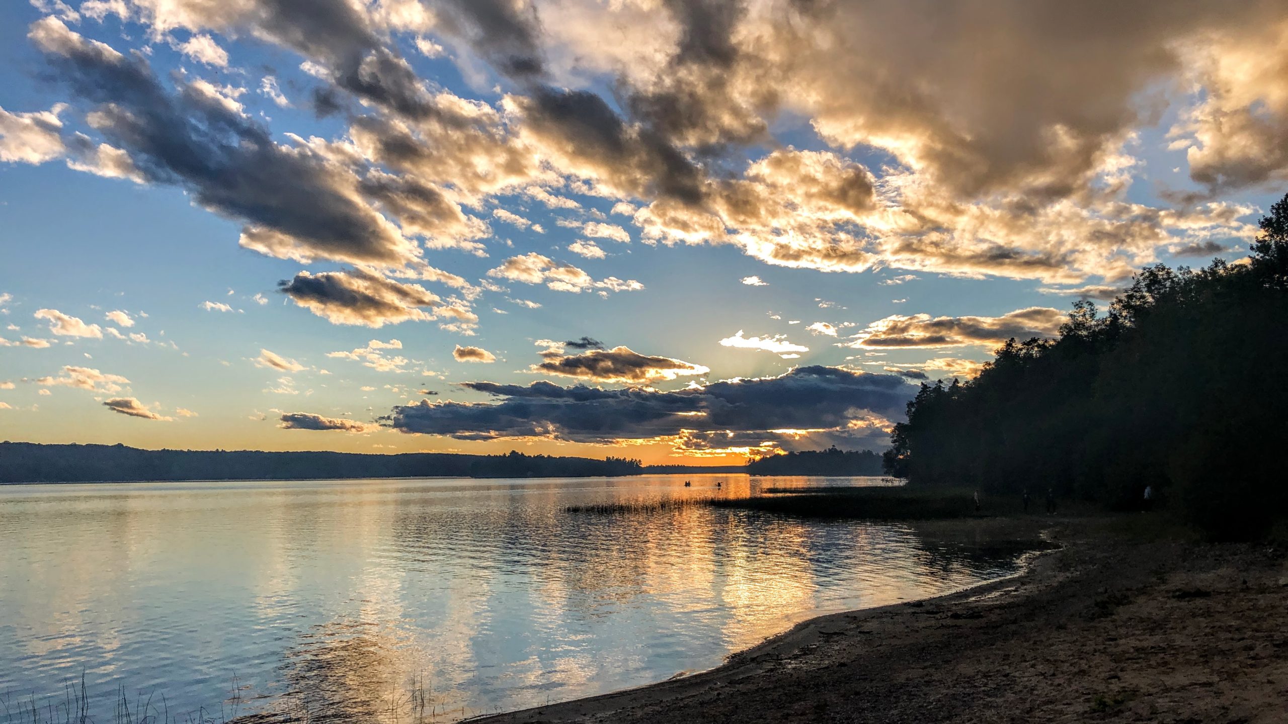
The beach at Putts is also home to the stunning sunsets you see below.
The downside to Putts was that the sites were fairly close together, with limited cover between them. The first time we came was during COVID, and with nowhere else for people to socialize, it was crazy, and the noise carried well. Our second visit in 2023 was much better, with more of a family vibe.
We did a quick drive through Bells Point, whose sites appeared to have better spacing and more privacy. The downside is no direct access to a beach.
Although we didn’t visit Kettle Point, it does appear to be home to all the electrical campsites, and beach access. The downside is similar spacing to Putts’, at least based on the map view.
Hiking and Mountain Biking at Restoule Provincial Park
There are many different hiking options at Restoule.
Fire Tower Trail
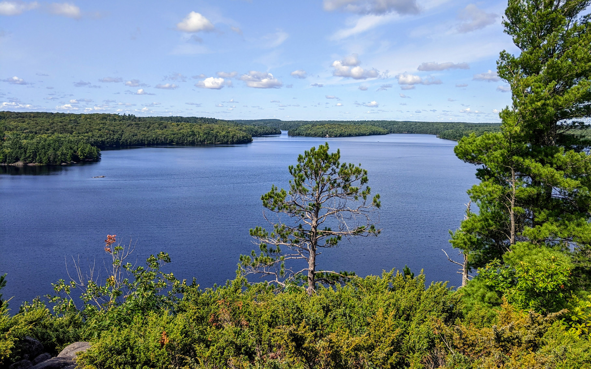
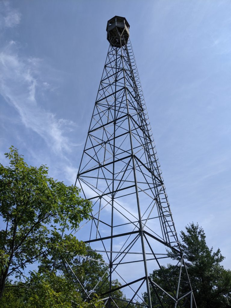
The Fire Tower Trail is labelled as the must-do trail at Restoule, and it didn’t disappoint. The trail consists of a 4.1km, relatively difficult climb to the top of the 100-meter-high Stormy Lake Bluff. The route is both relatively easy for the sure-footed, but would be quite advanced for the less steady amongst us.
Just a few meters down the trail, you will reach the fire tower itself.
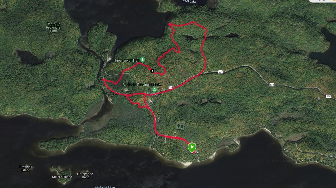
One word of warning. After taking in the views of the fire tower, I took the first trail I saw down. It wasn’t until halfway down that I began to question my choice. Where the trail was a hiking trail on the way up, it was a gentle ATV trail on the way down. Although I knew I must be on the wrong path, the direction felt right, so I decided to continue on. In the end, rather than ending up in the parking lot about 600 meters past the entrance gate, I ended up outside the park about 600 meters before the gate.
This could be the trick for anyone looking for an easier way up and down the entire trail. As you can see in the image below, my alternate path down took me just outside the park entrance, approximately 630 meters from the entrance.
Rangers Point Trail
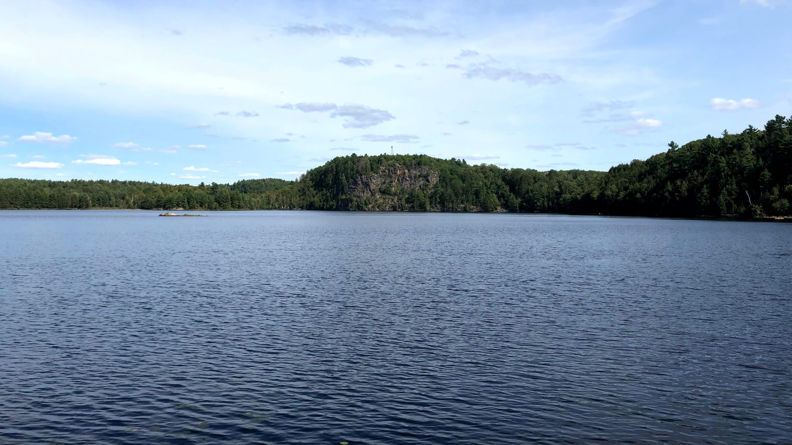
Rangers Point Trail is probably the second most important, must-visit trail in Restoule. It’s an easy hike with highlights, including views of Stormy Lake, the Stormy Lake Bluffs, and the Fire Tower.
River Trail
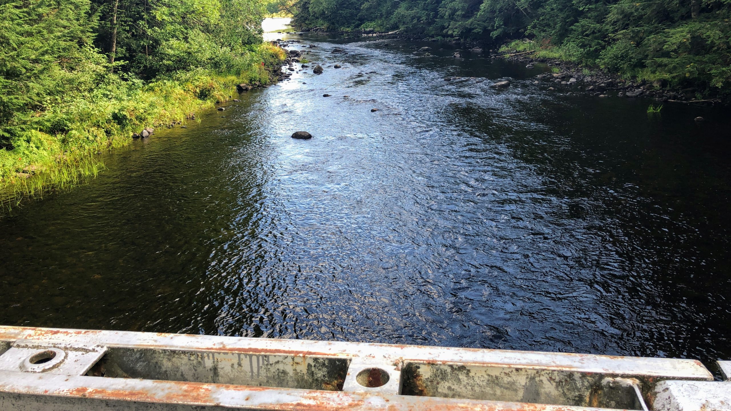
After leaving the parking lot, you will cross this small bridge across the river that connects Restoule and Stormy Lakes. The River Trail is a short 1.2km, fairly easy trail over mostly flat terrain before a moderate hill into the finish.
This is the perfect trail if you want to gain a deeper appreciation for the forests around this part of Ontario. Do note that we walked the trail after a few days of intermittent rain, and some parts of the uphill section had poor drainage, leading to a mildly muddy hike.
Grawbarger Trail
The Grawbarger Trail is a short hiking and biking trail that links the campgrounds to the various hiking trails, as well as Stormy Lake access points.
Angel’s Point and Gibbs Trail
Although I didn’t have the opportunity to visit them this time, there are two other trails to explore. Angel’s Point is a mixed-use hiking and biking trail, and the Gibbs Trail is a longer, unmaintained hiking trail designed for the more experienced hiker.
Paddling and Backcountry at Restoule
There are five day paddling routes at Restoule ranging in length from 2.5 to 14km.
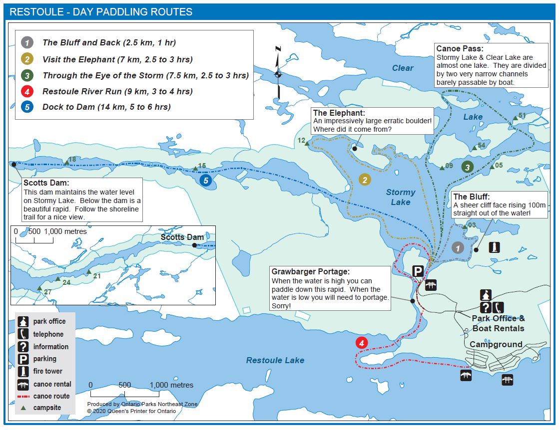
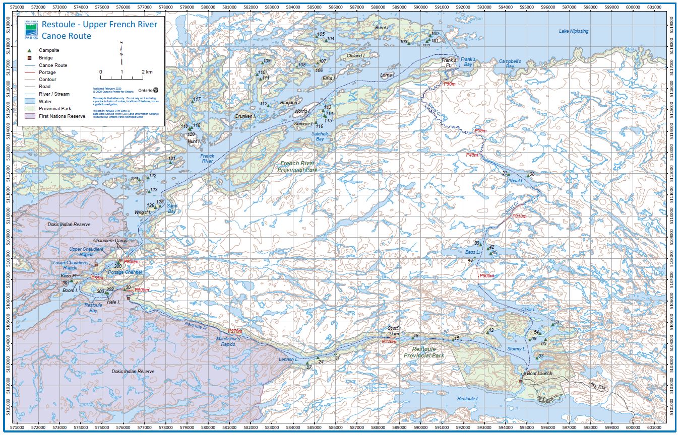
Restoule also offers extensive backcountry camping sites throughout Stormy Lake, Restoule River, and the historic French River.
Town of Restoule
🏙️- The town of Restoulle is about five km away, offering dining, a store, and gas.
⛽- The gas station closes early, make sure you fill up, as the next stop I could find was about forty minutes away.
Thanks for reading,
Cory
Was there a park table provided at each campsite?
Yes. So far, every provincial park I’ve been to has had a park table at each campsite, including Restoule.
If you had a kayak and choose a site close to the water, could you easily drag it down to the beach and launch from there?
I apologize for the delay. If the site is close to the water you should be fine. In Putts Campground it was a gentle slope down to the water.